
Milestones and Markers of the Exeter Turnpike Trust 1753-1884
Page added 29th September 2010
Return to the Transport menu
Also see Toll Houses of the Turnpike Trust
This history by Tim Jenkinson, follows the formation of the Exeter Turnpike Trust, and the design and placing of the many
mile stones for which they were responsible. On a related theme, Tim Jenkinson's and Patrick Taylor have co-authored two books on toll houses in Devon – The Toll Houses of South Devon and The Toll Houses of North Devon. The
books contains information of many toll houses across Devon,
along with details of the toll house keepers. You can purchase a copy of either book, from Tim Jenkinson directly - email Tim for more details at ![]() All
photographs and text for this article kindly supplied by Tim Jenkinson.
All
photographs and text for this article kindly supplied by Tim Jenkinson.
It was an Act of Parliament (26 Geo II c38) of 1753 that led to the formation of the Exeter Turnpike Trust, to manage a wide remit of roads leading into the city. At its peak the Trust was responsible for the repair and maintenance of some 146 miles of road easily making it largest in the county. On the major routes out of the city and as new sections of road were built the Trust erected a series of milestones, at one mile intervals, to inform the horse drawn traveller of distances to towns and cities. This included, along the main roads to Honiton, Plymouth and Teignmouth distinctive markers with distances to London. It was the General Turnpike Act of 1767 that made the setting of milestones at the roadside throughout the country compulsory and from this date the Exeter Turnpike Trust duly obliged opting for granite, a durable stone, to mark the way.
Styles of stone
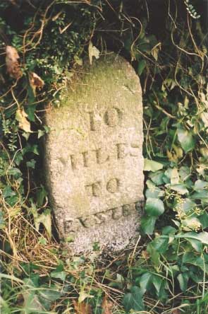
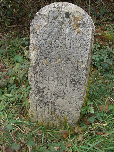
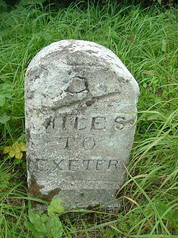
From the stones that survive in the early part of the 21st century it seems that the Trust opted for three main designs. Tall rather elaborate stones with square bases and facetted sides were a feature of the important roads out of the city. These as previously mentioned characteristically showed mileage to the capital, engraved on their bases and most often picked out in black to accentuate their appearance. It is possible that at one time the whole stone would have been painted white and the legend in black to maximise visibility. The sides of the stone usually show mileage to a nearby town along with the distance to Exeter, as can be seen with the stone in the village of Kenn on the Plymouth road (old A38) that shows a distance of 6 miles to Chudleigh. Unfortunately this style of stone is rather susceptible to damage on the projecting front edge and there are many examples where large chunks of granite have been knocked out of the stones by passing traffic.
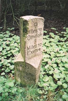
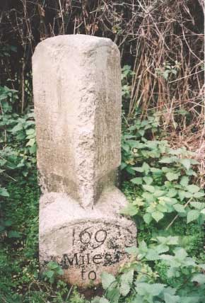
Another favoured design of the Trust was that commonly known as the 'small tombstone' type. Made of granite these stones were mostly placed by the Trust along roads of less importance or sufficiently far enough from the city to warrant their use. Today those still extant are fairly unobtrusive, easily overlooked and they are in considerable danger of neglect, damage and even theft. When the Turnpike Trust ceased to operate in 1884 the responsibility for road repairs passed to the newly formed County Council along with ownership of all milestones and other wayside markers such as Parish boundary stones. It was the Highways Act of 1980 that made the unofficial removal of milestones illegal and any unwarranted disappearance of a marker is now to be considered a criminal act.
The smaller Exeter stones are still in evidence along the old A30 towards Cornwall but again difficult to espy. One of these at Tedburn St Mary 7 miles from the city, was repaired in January 2008 and reset at the roadside by Devon County Council following a road traffic accident. The Milestone Society was instrumental in negotiations over its reinstatement. The limit of the Trust on this road extended as far as Crockernwell, some 11 miles from the city, and this is where a remarkable collection of three Grade II listed stones are set into a wall on the north side of the road to mark the passing over of responsibility to the Okehampton Turnpike.
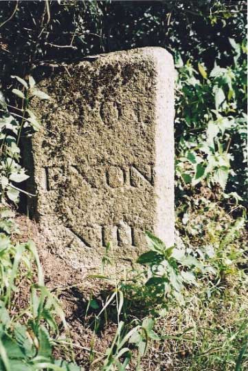
More of the plain milestones can be seen on old roads towards Plymouth through Shillingford, Ide and Dunchideock, whilst there is a run of neglected stones on the rural road to Stockleigh Pomeroy. Only two survive on the A377 as far as Crediton and there are others out to Tiverton on both old and new (A396) routes and into Cullompton via Bradninch. There are also a few survivors along the old road from Crediton to Labbetts Cross near Chawleigh one of which at the hamlet of Frost near Morchard Bishop shows mileage recorded in Roman numerals and Exeter as 'Exon' a medieval Latin alternative. Several stones had this version inscribed sometimes with an interchange of Latin and English names on the same route along with a mix of Roman and Arabic numbers.
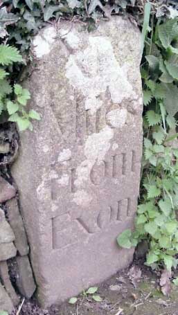
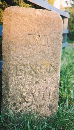
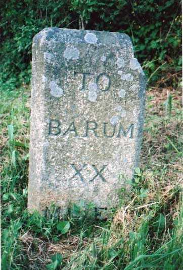
The third type of design can be mostly found along the A377 to Barnstaple particularly on the stretch between Copplestone and Eggesford. This road until the late 1980s and the build of the North Devon Link Road, was the main route between the city and town. Here the surviving stones have two faces and a front edge they show mileage to the city that is mostly recorded as 'Exon' on the left hand side, whereas the town is shown as 'Barum' on the right. Again the Exeter Trust has made use of Medieval Latin names and mixed these with Roman numerals and on several of the stones residues of black paint can still be seen in the carved inscription.
Barnstaple's own design
Beyond Eggesford, which was the point where Devon's two largest TurnpikeTrusts met, the style of the marker changes to a plain large tombstone that was favoured and set up by the Barnstaple Turnpike shortly before its closure in 1879. It is believed that 104 stones to cover every mile of their remit were paid for and placed by the Trust to be 'measured from a common centre of the whole of Barnstaple roads, at an expense not exceeding £200' (WH Rogers 1942). This central point was the Guildhall in the town centre. Another similar shaped stone to ones on the A377, albeit badly eroded can be found on an old section of the Exeter to Cullompton road at Venny Bridges. The inscription on the stone is hardly discernable but it stands at the two mile point from the city and is marked as ten from the town. Strangely the other stones surviving on this route are of the tombstone variety.
Turnpike Trust Terminus Stones
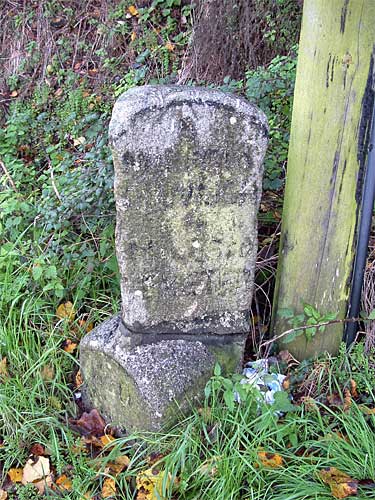
The Exeter Trust like other turnpikes in Devon chose to mark the end of their responsibility for road repairs by placing a sturdy granite stone, suitably inscribed with details indicating the change of ownership. There are today just three of these stones known to be surviving in the county one on the rising road from the village of Dunchideock on the old route to Chudleigh over Haldon Hill that is inscribed 'HERE/ends the Exeter/TRUST/'. There is another in Crockernwell on the old A30 road to Launceston similarly marked 'Here/Ends/Exeter/Trust/' and one other at Labbetts Cross on the old road from Crediton to Barnstaple that shows 'Here/ends the/Exeter /Turnpike/'. The stone in Crockernwell is one of three Turnpike markers set in a wall, the middle of which measures a distance of 11 miles from Exe Bridge. Terminus stones were an integral part of the Turnpike system as they clearly marked the boundaries between Trusts. Given its lengthy remit it is perhaps surprising to find so few of the Exeter stones remaining.
Threats to Milestones along Exeter Roads
There are considerable threats to the continuing existence of milestones at the roadside. The Milestone Society, a registered charity, is currently surveying roads in Devon and is furnishing Devon County Council with details of their locations and condition to inform their Historic Environment Record (HER). The main problems often emanate from the actual position of the stone at the roadside. In the days when they were set up it is unlikely that many would have been broken or chipped from passing horse drawn traffic but today in the 21st Century there are several that constantly face the risk of impact or vibration damage from motorised vehicles as they rumble by.
Exeter stones face the ongoing threat of decades of neglect and if overgrown with vegetation, continually run the risk of damage from careless grass or hedge cutting machinery. There are several ailing stones that have large chunks of granite missing from their tops or edges or have become buried or badly sunken in banks. For this reason it is imperative that vegetation, particularly in the summer months is vigilantly cleared from the stones as much as possible, so as to make them more visible, but sadly every year more damage occurs. Another risk for some of the smaller Exeter markers in recent years has been that of theft, stones that have been taken illegally from the wayside and sold on to dealers or erected in people's gardens. Under the Highways Act of 1980 it is an offence to remove a wayside marker without due permission. One such stone on the outskirts of Chudleigh on the old A38 disappeared as recently as August 2004. Although police and local press were alerted to the loss the early 19th Century stone was never recovered.
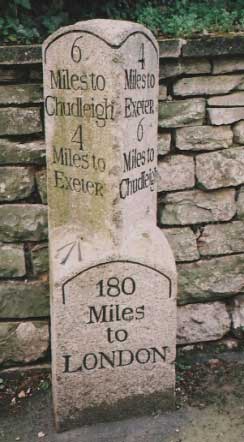
 < Kenn - old A30
Exminster - A379 >
 < Rockbeare (old A38)
Tedburn St Mary (old A30) >
 < Frost
Chudleigh Police Station (old A38) >
 < Lapford A377
Eggesford Forest A377 >
 < Copplestone A377
Dunchideock >

 < Crockernwell (old A38)
Labbets Cross >
 < Broken milestone, Exminster
Damaged stone, Woodleigh(old A30) >
│ Top of Page │