
Bull Meadow Park
Page updated 21st September 2016
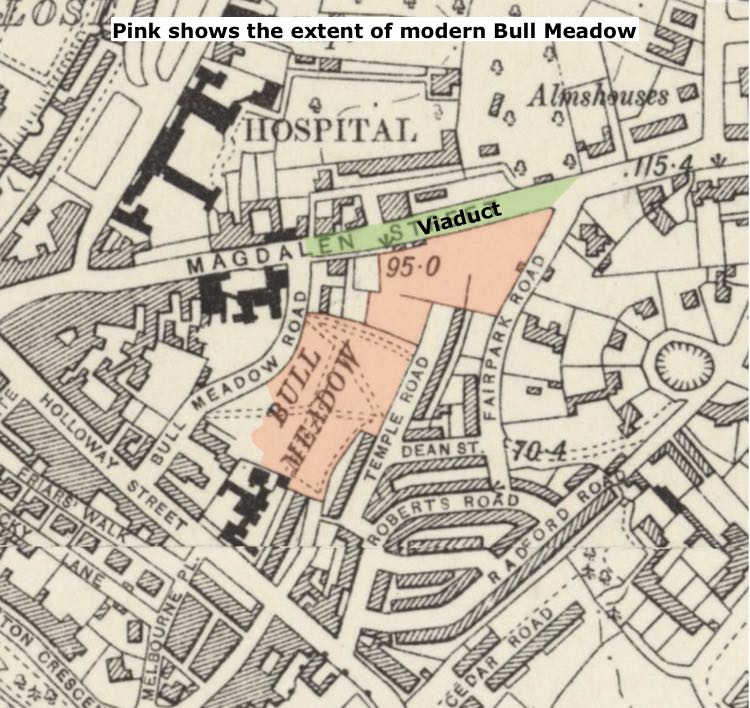 This park situated between Holloway Street and Magdalen Street, is the last open remnant of the Chutebrook (aka Sutebrook and Shytebrook) Valley. The Chutebrook rose in Chute Street and flowed past the bottom of Paris Street, crossed Magdalen Street and flowed into the Exe at the bottom of Colleton Hill. The name is a corruption of the Saxon 'shyte' because it was used as a conduit for human sewage. The whole watercourse was buried in a conduit and now carries only storm water. The valley that the viaduct crosses, was considered one of the most difficult for carriages, carts and animals to cross as the sides were steep and slippery.
The park was named after the Bull Inn, which was first mentioned in 1487 and which was situated on Magdalen Street. In the 16th to the18th Century, Bull Meadow, along with parts of Friernhay, was used as rack fields for John Baring, whose business was based in Great Larkbeare House.
 In the 12th Century, a hospital for 13 lepers was built at a safe distance outside the South Gate, in what is now, the north east corner of Bull Meadow. It was known as the St Mary Magdalene Hospital and hence, the road became known as Magdalen Street.
At the demise of the serge industry at the end of the 18th Century, Bull Meadow, was owned by the City Chamber, and leased out. By the 1870s, Sir John Smale leased the land–he lived in a house on the edge. The City Council were keen at the time to take back control of much of their land in the city for house building. Bury Meadow could not be repossessed until the end of the lease, or Sir John died. In January 1882, at the age of 82, Sir John offered to release Bull Meadow to the council if they agreed to him keeping a small portion of the land, the Ice House, and an annuity of £30 per annum. He added “… having regard to my state of health, I may, without presumption, say is in all probability more remote then, according to the ordinary average, might be anticipated.” He was wrong and died the next August, allowing Bull Meadow to fall into the Council’s hands.
The Council had designs on using the land to build houses. However, the locals of Trinity Parish were having none of this and in September 1883 they submitted a memorial requesting that the 3½ acres of land become a recreation ground. The Public Health Act of 1875 required Councils to provide recreation grounds, and a month later, the Council agreed to the proposal, producing a sketch plan. Negotiations with property owners, both from Magdalen Road and Lansdowne Terrace continued, while the Council tried to hive off parts of the land for housing. A new road was cut, in 1888, joining Holloway Street to Magdalen Road, and losing half an acre from the proposed Bull Meadow Park.
It took until February 1889 for the final decision to make a park out of the remaining land. Garton and King were contracted to provide iron railings and gates for the sum of £73–sadly they were removed in the Second World War for munitions. The park was designated, as a Recreation and Pleasure Ground, although work was still in progress laying it out. Forty trees were planted at a cost of £7 in December 1890. The pleasure ground seems to have opened with little ceremony, nor enthusiasm. There were complaints that public seating had not been provided, and the Council were accused of lacking effort in completing the pleasure ground.
A few years later, in August 1903, a letter appeared in the Western Times from ‘A Resident’ complaining about the state of the pleasure ground, “… the householders, who are now subjected to all kinds of annoyances–broken windows, passage doors, etc. Even persons are not safe from stones, and cricket balls.” The Council may have acted, but by 1908, local residents were again complaining about a Council deal to surrender half the area of the pleasure ground for building, in exchange for a larger area at Mount Radford Lawn for another pleasure ground. In the event, the plan did not go through.
The viaduct across the Chutebrook
Attempts had been made in the 16th Century to improve the road dropping into the little valley of the Chutebrook, but they made little difference to improve the way. A letter in an 1830 edition of the Exeter and Plymouth Gazette describes the drop into the Chute Valley thus:
“… it is more the character of a ravine, than a road, and a principal approach to the city should certainly be made safe. This, however, cannot be said to be the case; this sharp hill is the terror of all nervous and fat people journeying this way in gigs, phaetons and the like, while for carts, waggons, &c. of which they are now becoming numerous in conveying heavy building materials, &c. To and from this neighbourhood, it is really distressing for cattle to drag up over it…”
Comments about the steep slope for carts hauling building materials continued until 1834 when plans were made to smooth out the slopes–but plans are plans, not action and nothing was done by 1836. A model of the proposed viaduct, which was estimated to cost £1,200, was shown in August 1838 by the Turnpike Trustees, with support from Mr Hooper, who coincidentally, was developing St Leonards, and area that would profit from a viaduct. Agreement had to be made between The Commission and Turnpike Trust, and the purchase of several cottages, for clearance. The first stone of the viaduct was laid on 21 December 1838 by Samuel Kingdon. The viaduct was in use by July 1840.
There was a substantial amount of earth used to cross the culvert–a retaining wall of Pocombe stone was built on each side, capped with Dartmoor granite. An arch was constructed at one end, just before Bull Hill, for the Chutebrook to flow through. The Bull Meadow car park on the corner of the inner by-pass and Magdalen Road is also at the level of the bottom of the valley, as is Bull Meadow itself. When the inner bypass was being planned in the 1950s, one design routed the road in the form of an overpass across Bull Meadow to meet Holloway Street near Melbourne Street. The actual bypass necessitated the removal of the retaining wall on one side as the road was raised above the valley floor.
The modern pleasure ground is much loved by locals. The City Council have created a small meadow of long grasses to boost insects for the local bat population, and installed nesting boxes to encourage the birds. Now the park contains a play area for children with a five-a-side pitch for children. There is also seating suitable for people to picnic.
Source: British Newspaper Archive, Discovering Exeter: St Leonard's by Gilbert Venn

The viaduct across the Chutebrook Valley is the northern edge of the park.
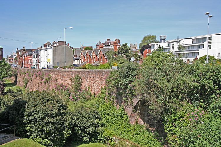
The viaduct and arch.
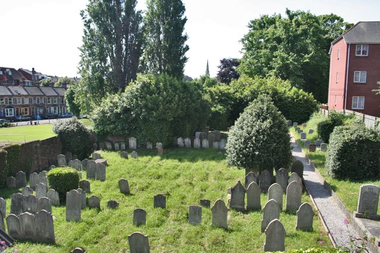
The Jews Cemetery–the park is left and beyond.
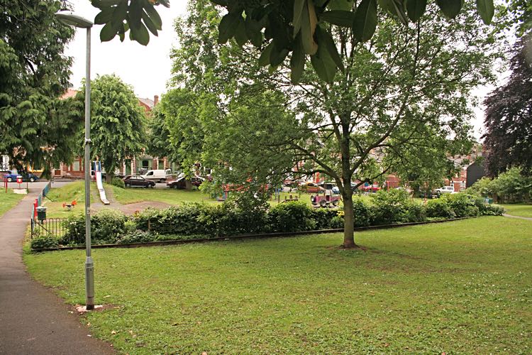
The slide in the children's playground.
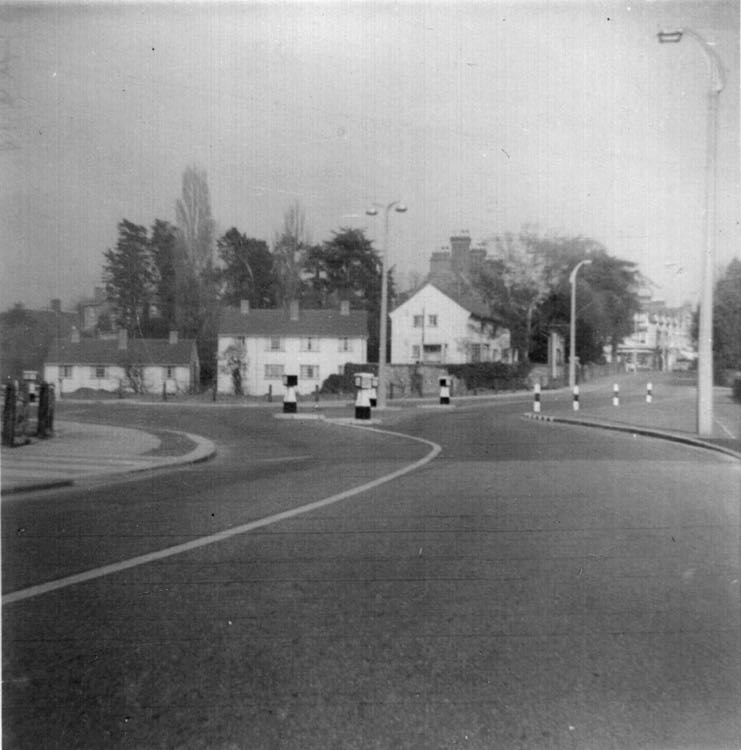
The Magdalen Road viaduct. Photo Dick Passmore.

The viaduct and the Jews Cemetery behind the wall. The photo was taken from close to the position of the St Mary and Magdalene leper hospital.
│ Top of Page │