
Lime Kiln Lane
Page updated 15 September 2008
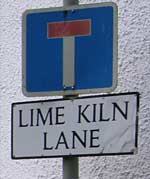 Named after a lime
kiln at its end, Lime Kiln Lane
is situated in Higher Wear, Countess
Wear. The lane leads towards the
river, where the kiln is dug into a
low cliff. Lime kilns were often situated on waterways, making it easy
to import limestone from Berry Head and coal, predominantly, from
Newcastle. The lime was used for building
and agriculture. In White's Devonshire Directory for 1850, the
limeburner in Countess Wear was listed as Davy and Son.
Much of the lime was used on the fields of St David's in the north
of
the city. Truckermucks, or carts without wheels, pulled by horses or
oxen, were used to carry the lime up the
Topsham Road, Holloway Street, up South Street and down North Street to
St David's Down.
The traders and inhabitants of South Street and North Street found
the
roadway often blocked with overturned truckermucks, and piles of lime.
The truckermucks also damaged the
surface, and eventually they were banned.
Named after a lime
kiln at its end, Lime Kiln Lane
is situated in Higher Wear, Countess
Wear. The lane leads towards the
river, where the kiln is dug into a
low cliff. Lime kilns were often situated on waterways, making it easy
to import limestone from Berry Head and coal, predominantly, from
Newcastle. The lime was used for building
and agriculture. In White's Devonshire Directory for 1850, the
limeburner in Countess Wear was listed as Davy and Son.
Much of the lime was used on the fields of St David's in the north
of
the city. Truckermucks, or carts without wheels, pulled by horses or
oxen, were used to carry the lime up the
Topsham Road, Holloway Street, up South Street and down North Street to
St David's Down.
The traders and inhabitants of South Street and North Street found
the
roadway often blocked with overturned truckermucks, and piles of lime.
The truckermucks also damaged the
surface, and eventually they were banned.
![]()

│ Top of Page │